
American spatial data does not arrive at the geography you need. Search interest is reported for 210 media markets, health estimates arrive by county, employment arrives by county and sector, and rents arrive by metro. The questions live somewhere else entirely: a trade area, a council district, the blocks within a five minute walk of a storefront.
The standard answers are both bad. You can analyze at the coarsest common geography and throw away the resolution of everything else, or you can build a one-off crosswalk that quietly invents precision it cannot defend.
This analysis surfaces a third answer: use a learned place representation as a common coordinate system, and move every dataset to the grain where the question lives. Grain mismatch stops being a modeling project and becomes a solved join.
The mechanism
Ether Data maintains a 128-dimension place embedding for every 460 meter hexagonal block in the United States, trained on structural features of place. Two properties make it a rescaling substrate.
First, coarse units are averages of their blocks. A media market's vector is the population-weighted mean of its member block vectors, so market vectors and block vectors occupy the same space and arithmetic moves cleanly between the two grains.
Second, a linear operation commutes with that averaging. Take a signal indexed at market grain, z-score the index across markets, and form the weighted sum of the market vectors. The result is a signal vector. Scoring any block by its resemblance to that vector produces a candidate fine-grain surface. Two corrections then make the surface honest. The within-market spread is shrunk by a calibrated slope, and the surface is rescaled so that the population-weighted block average inside each market equals the observed market number exactly. Whatever geography you later roll the blocks up to, the arithmetic ties out to the source data.
No model is fitted anywhere in this loop. The consumer of the substrate runs a weighted sum and an inner product.
The demonstration: search interest, from market to block
Google Trends reports search interest as an index across 210 US media markets, identified by standard market codes. We pulled six terms chosen for their geographic character: snow blower, hurricane shutters, tacos, clam chowder, pickleball, line dancing.
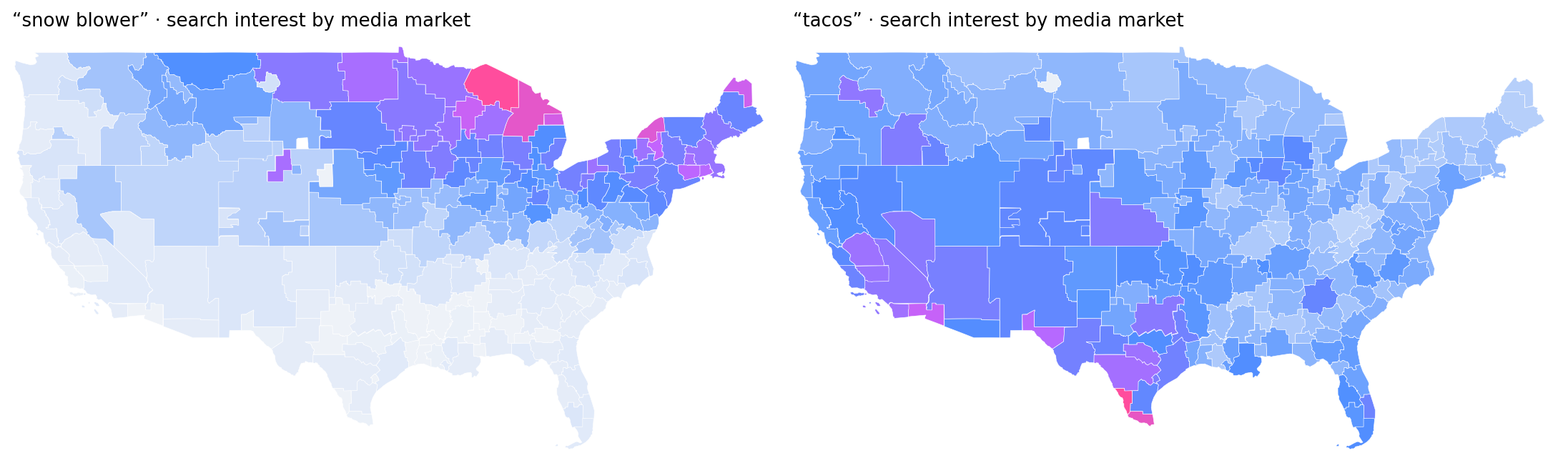
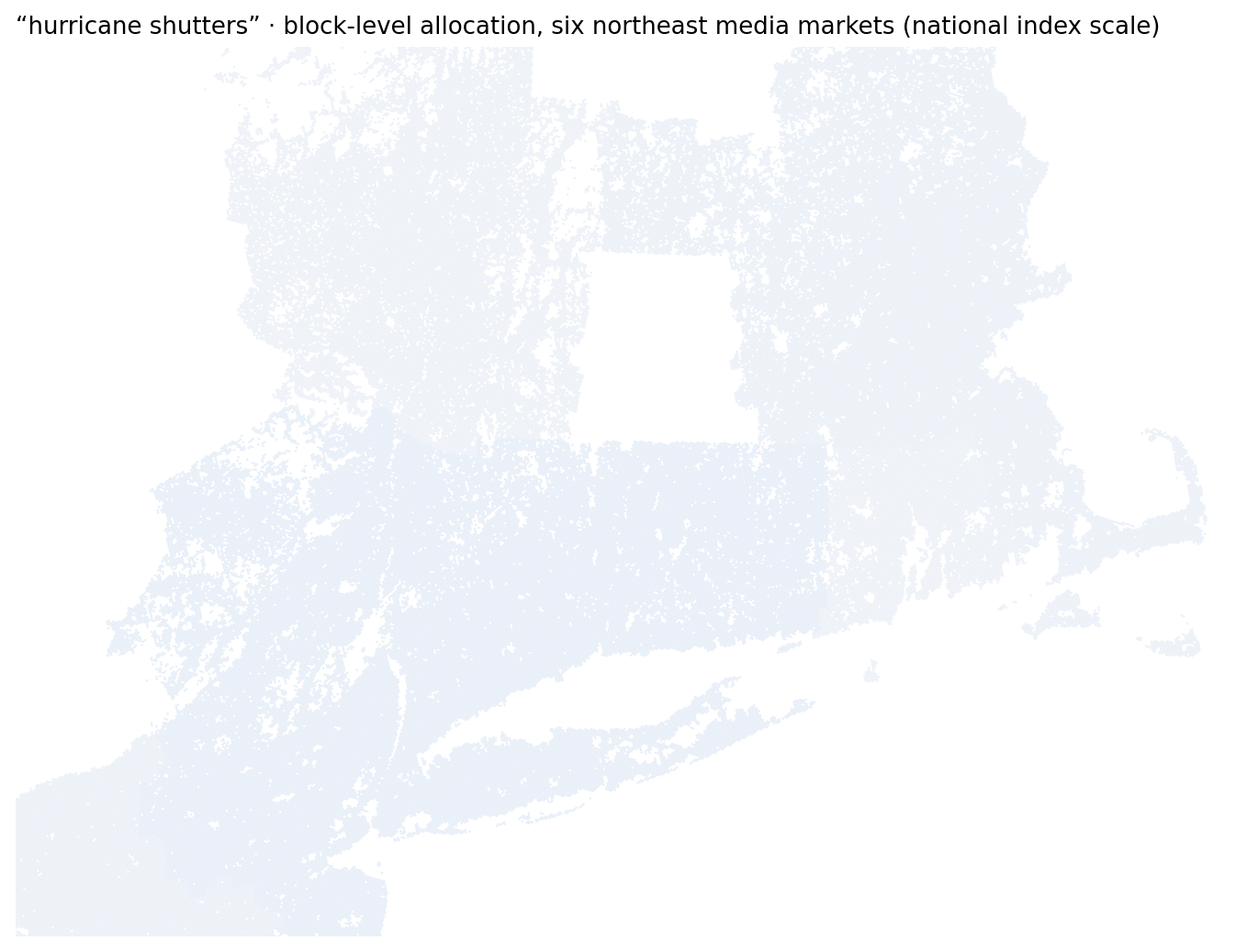
The market-grain maps already tell distinct stories. Snow blower interest concentrates in the northern tier and peaks in upper Michigan. Taco interest is national with a strong gradient toward the Texas border. Hurricane shutter interest barely exists outside Florida and the Gulf Coast.
Validation at the coarse grain uses a leave-one-market-out design: the signal vector that scores a market is always built without that market. On the six search terms, held-out market correlation ran from 0.41 for hurricane shutters to 0.74 for snow blower, with tacos at 0.66. On reference targets with dense physical coverage, including nighttime lights, points of interest, and cell tower density, the same recipe reaches 0.88 to 0.93. Those two ranges bracket what a market-indexed signal should expect.
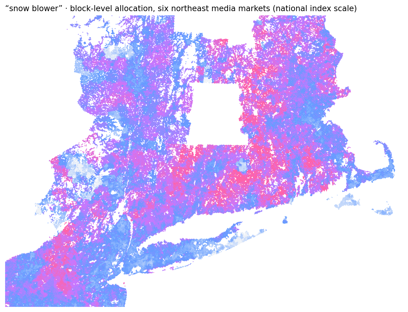
Projection then carries each signal down to the block. The surface below scores 129,688 blocks across six northeast media markets for snow blower demand, drawn in national index units.
What the validation does and does not support
Three findings from the validation battery carry the weight.
Where else the same move applies
The mechanism is indifferent to what the market-grain number means, which is what makes it general. A sample of what our advisory review surfaced, grouped by who benefits.
Media & measurement
MMM geo readouts from stacks like Robyn and Meridian project down to within-market budget surfaces - a geo prior, never block-level incrementality. Out-of-home sellers rank every frame's block catchment by category demand. Publishers price cookieless inventory by place, not person. Regional brand trackers become neighborhood brand-heat priors.
Operations & policy
County payroll becomes a daytime spending-power surface around a candidate site. CDC PLACES county health estimates become an outreach-ordering surface for clinics. USDA tract food-access flags re-aggregate to council districts and school zones. State EV registration counts become charger-siting demand priors.
Data engineering & AI
County, market, and tract tables key to block level and join directly. Forecast hierarchies reconcile with blocks as the base level. Geo experiments draw synthetic-control donors from resemblance-matched blocks. An AI agent asks at any grain and gets an answer at any grain, with provenance attached to every number.
What this is not
The prohibitions came out of the same review as the use cases, and they are part of the method. A downscaled surface is none of the following: a measurement, an impression count, an audience currency, or evidence about any individual or household. It should never be the input that denies someone a resource, and it should never stand in for measured units in entitlement formulas or litigation. Screening and prioritization are the honest jobs. Each surface should say what it is: allocated from the coarse grain, tied out to the published numbers.
Delivery
The substrate ships as two warehouse tables and one SQL statement. Rescaling runs inside the buyer's own data warehouse under existing access controls and billing, with no API keys, no rate limits, and no data leaving the perimeter. Any agent stack that can execute SQL can use it today.
Spatial data will keep arriving at whatever grain its collector chose. The coordinate system is how every grain becomes usable.